
Ohrid is often reduced to one beautiful composition.
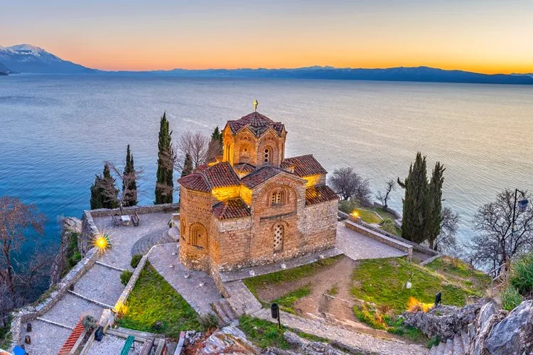
The Church of St. John at Kaneo stands on a cliff above the lake. The water stretches behind it, and the mountains close the horizon. It is one of the most recognisable views in Macedonia.
The view deserves its reputation, but Ohrid begins much earlier and continues far beyond it.
The city is a route. It moves from the old bazaar and the plane tree toward the lake, climbs through narrow streets between traditional houses, passes churches and archaeological layers, reaches Plaošnik and Samuel's Fortress, then descends again toward Kaneo and the water.
To understand Ohrid, follow that movement slowly.
Begin at the old bazaar, not at the viewpoint
The old bazaar is one of the most useful starting points because it places Ohrid in everyday life before the historic climb begins.
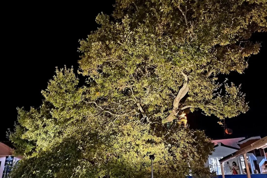
The main pedestrian street passes shops, cafés, bakeries, jewellery stores, and places connected with Ohrid pearl traditions. Near the upper end stands the old plane tree, commonly known as the Chinar, which remains a familiar meeting point.
This area can be busy and commercial, especially in summer, but it is not only a visitor zone. Residents pass through it, meet there, shop, and use it as a connection between neighbourhoods and the lakefront.
From the bazaar, continue toward the square and the harbour. The lake appears gradually rather than all at once.
This approach matters. Ohrid is not a historic settlement placed beside an empty landscape. It is a living city whose daily routines, tourism, religious heritage, and lake environment constantly overlap.
Walk by the water toward Kaneo
From the central lakefront, the route continues past old houses and smaller beaches toward the wooden walkway over the water.
This section is one of the clearest examples of how Ohrid changes within a short distance. The busy centre falls behind, the streets narrow, and the lake becomes physically closer.
The walkway leads toward Kaneo and the Church of St. John the Theologian. The church is often photographed from above, but it should also be approached from below. From the water level, the cliff, stone walls, and surrounding trees feel different.
The area around Kaneo becomes crowded at popular times. Early morning and later afternoon usually allow more space to notice the setting.
Do not stop only at the famous viewpoint. Continue uphill. The route above Kaneo connects naturally with Plaošnik and the upper old town.
Plaošnik holds several periods in one place
Plaošnik is not one single monument.
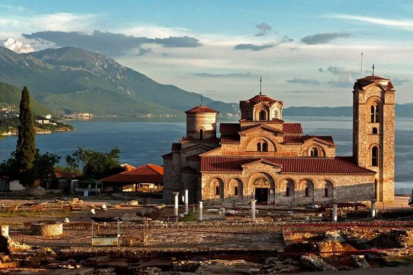
The area contains archaeological remains, religious buildings, and layers connected with the early Christian and medieval history of Ohrid. The reconstructed Church of St. Clement and St. Panteleimon stands within this wider archaeological landscape.
For Macedonian cultural memory, the place is closely connected with St. Clement of Ohrid and the tradition of literacy and education associated with the Ohrid Literary School.
For visitors, the most important thing is to look beyond one façade. Stone foundations, excavated areas, views toward the lake, and the position between Kaneo and the fortress make Plaošnik a place where several periods remain visible together.
This is also a good point to slow down. The old town route is steep, and moving too quickly turns heritage into a sequence of photographs.
Plaošnik is more meaningful when read as part of the hill rather than as an isolated stop.
Samuel's Fortress explains the shape of the old town
Samuel's Fortress stands above Ohrid and defines the upper edge of the historic city.
From its walls, the relationship between the lake, old town, harbour, Plaošnik, surrounding neighbourhoods, and mountains becomes easier to understand.
The climb is part of the experience. Streets become steeper, houses open onto unexpected views, and the lake repeatedly appears between walls and roofs.
The fortress is associated with the medieval period and with Tsar Samuel. Its present form reflects both historical use and later conservation.
What matters most for this article is the perspective. From above, Ohrid no longer looks like a thin line of buildings along the shore. It becomes a settlement shaped by defence, religion, trade, terrain, and constant proximity to the lake.
When returning downhill, choose a different street. The old town changes from one route to another.
The houses are part of the heritage
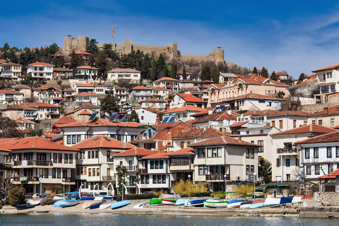
Ohrid's traditional urban houses are easy to notice because their upper floors often project outward above narrower stone bases.
This form responds to the steep terrain and limited space within the old town. It also gives the streets their distinctive scale.
Some of the best-known houses, including the Robev House, now serve cultural or museum functions. Others remain part of the residential fabric.
The important point is that the old town is not only a collection of churches. Its domestic architecture, courtyards, walls, views, and narrow passages are equally important to the experience.
Walk without looking only upward toward monuments. Notice doors, windows, rooflines, stone paving, and the way houses frame small sections of the lake.
These details make Ohrid feel inhabited rather than staged.
The lake is heritage, not a background
UNESCO recognises the Ohrid region for both natural and cultural heritage.
That combined status matters. The lake is not simply a blue surface behind churches and houses. It is an ancient ecosystem, a source of local identity, and a living environment that requires protection.
The pressure of construction, traffic, waste, and heavy tourism can affect both the city and the lake. Loving Ohrid therefore also means behaving carefully within it.
Use established paths. Avoid leaving waste. Respect religious spaces and residential streets. Choose licensed boat services. Do not treat protected species or the lake itself as unlimited resources.
Ohrid has survived because natural and cultural history developed together. The city cannot be preserved while the lake is ignored.
Stay until the evening changes the city
During the day, Ohrid can feel like a sequence of sights.
In the evening, it becomes social again.
People walk along the quay, meet for coffee, sit beside the water, return from the beaches, or move through the bazaar after the strongest heat has passed. Families, residents, visitors, and young people share the same public spaces.
This is when the city becomes more than a heritage route.
Ohrid is not only Kaneo at sunset. It is the walk before it, the climb above it, the houses around it, and the conversation that continues after the photograph has been taken.
Come for the famous view. Give the rest of the city equal time.